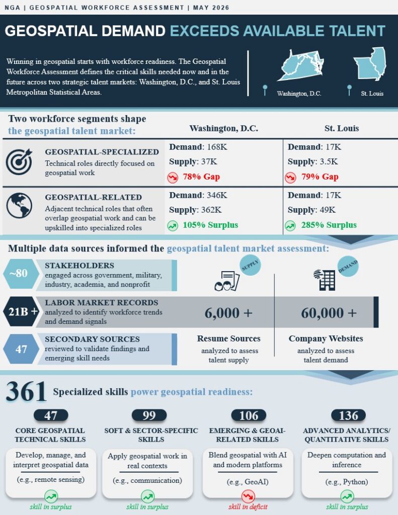
Explore the comprehensive assessment of the regional landscape, examining the challenges and opportunities shaping the future of geospatial technology and workforce development.
Click Image to Expand
Behind the Assessment
The Geospatial Workforce Assessment was part of the Geospatial Workforce Development Program. This program was mandated by the 2025 NDAA to develop a skilled workforce in geospatial technologies to support DoD defense intelligence requirements aiming to accelerate the development of today’s workforce, enhance the geospatial professionals of tomorrow’s workforce, and proactively engage with our geospatial partners as a trusted member of the community.
As part of this initiative, our Partnership Intermediary Agreement (PIA) brought together government and university collaborators to analyze labor demand, map existing programs, engage stakeholders for qualitative data, and assess the geospatial market landscape.